Monday, December 18, 2006
How close is too close? It is speculative, unless and until ...
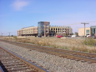
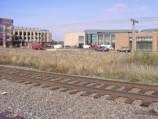
With the Sunday, Dec. 17 BNSF 30-car derailment in Coon Rapids, the "headline" question applies. As does the answer. The question for many in Ramsey, is how close are things now? If you have not looked for yourself, photos are presented. You be the judge.
Finally, photograph perspectives can trick the eye, and I do not have measurements of actual setbacks from the tracks. Next time you go south, behind the ramp and building, have a look. If a train passes while you are there, figure what a derailment at that speed might do. Figure how you might find your auto if parked on the ramp ground floor when a derailment event occurs. Figure if you're on the sidewalk between a building and a derailing train. Remember the old saying that, "Discretion is the better part of valor," and that there is on-street parking on the north side of Sunwood, along the road by Ben the taxpayer which would put quite expensive but effective taxpayer-purchased structural shock absorbing mass between you and any derailing train. Perhaps someone might consider installing rail-side berming? Berming could be done, if there's funds left for Ramsey to be able to afford it.
Remember, the Coon Rapids derailment was at the Hansen Blvd. crossing where trains proceed substantially slower than through Ramsey.


